beautypg.com
Manuals
Brands
Garmin Manuals
Avionics Display
G1000 NXi
Garmin G1000 NXi Manuals
Manuals and User Guides for Garmin G1000 NXi. We have
8
Garmin G1000 NXi manuals available for free PDF download: Pilot's Manual, System Maintenance Manual, Cockpit Reference Manual, Reference Manual, Supplemental Maintenance Manual
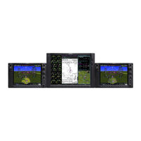
Garmin G1000 NXi Pilot's Manual (538 pages)
Brand:
Garmin
| Category:
Autopilot System
| Size: 28.63 MB
Table of Contents
Table of Contents
17
Section 1 System Overview
21
System Description
21
Line Replaceable Units (LRU)
21
System Controls
24
PFD/MFD Controls
24
SD Cards
27
System Operation
28
System Power-On
28
Normal Operation
29
Reversionary Mode
29
System Annunciations
30
System Status
31
ADAHRS Operation
32
AHRS Operation
33
GPS Receiver Operation
35
Accessing System Functionality
40
Softkey Function
40
Menus
45
Mfd Page Groups
46
Split Screen Functionality
48
System Settings
49
System Utilities
54
Display Backlighting
58
Section 2 Flight Instruments
59
Flight Instruments
62
Attitude Indicator
62
Airspeed Indicator
63
Altimeter
64
Vertical Speed Indicator (VSI)
68
Vertical Deviation
68
Vertical Navigation (VNV) Indications
71
Horizontal Situation Indicator (HSI)
72
Course Deviation Indicator (CDI)
77
Supplemental Flight Data
84
Generic Timer
84
Temperature Display
84
Wind Data
85
Synthetic Vision Technology (SVT)
86
SVT Operation
87
SVT Features
88
Field of View
97
PFD Annunciations and Alerting Functions
99
Altitude Alerting
99
Baro Transition Alerts
99
BARO QFE Indications
100
Low Altitude Annunciation
100
Marker Beacon Annunciations
100
Minimum Altitude Alerting
101
Abnormal Operations
102
Abnormal GPS Conditions
102
Garmin SVT Troubleshooting
102
SVT in Reversionary Mode
103
Unusual Attitudes
103
SVT Unusual Attitudes
104
Section 3 Engine Indication System
105
Engine Display
106
Engine Display
118
EIS Display (Reversionary Mode)
123
Section 4 Audio Panel and Cns
125
Overview
125
PFD Controls and Frequency Display
126
Audio Panel Controls
128
COM Operation
132
COM Tuning Boxes
132
COM Transceiver Manual Tuning
133
Auto-Tuning the COM Frequency
133
Frequency Spacing
136
NAV Operation
137
NAV Tuning Boxes
137
NAV Radio Selection and Activation
138
NAV Receiver Manual Tuning
138
Auto-Tuning a NAV Frequency from the MFD
138
Marker Beacon Receiver
141
DME Tuning
142
Mode S Transponder
143
Transponder Controls
143
Transponder Mode Selection
144
Entering a Transponder Code
146
IDENT Function
146
Flight ID Reporting
147
Additional Audio Panel Functions
148
Power-Application
148
Mono/Stereo Headsets
148
Speaker (GMA 1347)
148
Speaker (GMA 1360)
148
Passenger Address Mode (PA Mode)
148
Intercom (GMA 1347)
148
Intercom (GMA 1360)
150
Split-Com Mode (GMA 1347)
152
Split-Com Mode (GMA 1360)
152
Blue-Select Mode (GMA 1360)
152
Audio (GMA 1360)
153
Bluetooth (GMA 1360)
154
Clearance Recorder and Player
155
Telephone and Entertainment Inputs
155
Audio Panels Preflight Procedure
157
Abnormal Operation
158
Stuck Microphone
158
COM Tuning Failure
158
Audio Panel Fail-Safe Operation
158
Reversionary Mode
158
Section 5 Flight Management
159
Introduction
159
Navigation Status Box and Data Bar
161
Using Map Displays
163
Map Orientation
163
Map Range
165
Map Panning
167
Measuring Bearing and Distance
169
Topography
170
Map Symbols
172
Airways
176
Additional Navigation Map Items
178
Waypoints
181
Airports
182
Non-Airport Waypoints
188
Airspaces
196
Nearest Airspace
197
Smart Airspace
199
Direct-To Navigation
200
Flight Planning
204
Flight Plan Views
207
Creating a Flight Plan
209
Flight Plan Waypoint and Airway Modifications
211
Flight Plan Operations
218
Closest Point of FPL
222
Garmin G1000 NXi System Maintenance Manual (403 pages)
Brand:
Garmin
| Category:
Autopilot System
| Size: 9.27 MB
Table of Contents
Table of Contents
4
Introduction
14
Content, Scope, Purpose
14
Organization
15
Definitions/Abbreviations
16
Units of Measure
17
Publications
17
Table 1-1, Required Documents
17
Table 1-2, Reference Publications
18
Revision and Distribution
19
System Description
20
Equipment Descriptions
20
Figure 2-1, Display Units
21
Figure 2-2, Flight Stream 510
22
Figure 2-3, Audio Panel
22
Figure 2-4, AFCS Controller
23
Figure 2-5, FMS Controller
23
Figure 2-6, Transponders
24
Figure 2-7, GIA Unit
26
Figure 2-8, GEA Unit
26
Figure 2-9, GSU-75B ADAHRS with Connector and Mounting Tray
27
Figure 2-10, GDC 7400 Air Data Computer
28
Figure 2-11, OAT Probe
28
Figure 2-12, AHRS
29
Figure 2-13, Magnetometer
30
Figure 2-14, GDL 69A/69A SXM Datalink
30
Figure 2-15, GDL 59 Wi-Fi Datalink
31
Figure 2-16, GSR 56 Satellite Receiver
31
Figure 2-17, GSD 41 Data Concentrator
32
Figure 2-18, GTS 820/850 Traffic System
32
Figure 2-19, GTS Traffic Processor
33
Figure 2-20, Weather Radar
33
Figure 2-21, Servo
34
Figure 2-22, GSA 9000 / GSM 9100
34
Figure 2-23, GRA 5500 Radar Altimeter
34
Figure 2-24, MD 302 Standby Attitude Module
35
G1000 Optional Interfaces
36
Electrical Power Distribution
37
Figure 2-25, 300 Series Electrical Distribution (Post G1000 STC)
38
Figure 2-26, G1000 Component Power Sources
39
Electrical Load Utilization
40
Table 2-1, Electrical Loads
40
Pitot/Static System
48
Figure 2-27, Pitot/Static System with ADC(S) and AHRS(S) Installed
48
Figure 2-28, Pitot/Static System with GDU 75B ADAHRS(S) Installed
49
Shield Block Grounds
50
G1000Nxi /GFC700 Block Diagrams
50
Figure 2-29, G1000Nxi/Gfc 700 Block Diagram with GSU 75B ADAHRS
50
Figure 2-30, G1000Nxi/Gfc 700 Block Diagram with Separate ADC and AHRS
51
GDU 1050A and GDU 1550 Displays
52
Figure 2-31, GDU 1050A Control Interface
52
Figure 2-32, GDU 1550 Control Interface
52
Softkeys
53
FMS Knob
53
Figure 2-33, G1000 Softkeys
53
GCU 477 - MFD Controller
54
GMC 710 - AFCS Controls
54
Figure 2-34, MFD Controls (GCU 477 Shown)
54
Figure 2-35, AFCS Controls (GMC 710 Shown)
54
GMA 1347D Audio Panel
55
Figure 2-36, GMA 1347D Controls
55
G1000 Normal Mode
56
Reversionary Mode
57
Figure 2-37, Normal Mode
57
Figure 2-38, Automatic Reversion with MFD Failure
57
Figure 2-39, Manual Reversion with Pilot PFD Failure
57
Software and Configuration
58
Configuration Mode Overview
58
Figure 3-1, SET>ACTV Diagram
59
Figure 3-2, Loss of Communication
60
Figure 3-3, Configuration Status
60
Figure 3-4, Data Transmission Indicators
60
G1000 System Software Information
63
Figure 3-5, G1000 LRU Configuration File Storage
70
Figure 3-6, GSU/GRS/GDC Configuration Settings Storage
71
Configuration Mode
72
G1000 Hardware/Software Compatibility Check
72
Equipment Verification (Third Party/Optional Equipment Documentation)
73
Figure 3-7, Garmin Unit S/N Location
74
Figure 3-8, Garmin Unit Listed if Installed
75
Figure 3-9, Ethernet Connections Page
76
Figure 3-10, ESP Status Field
77
Configuration Checklist
78
G1000 Software/Configuration Procedure
80
Figure 3-11, Software/Configuration Overview
80
System Software and Configuration Load
81
Feature Enablement
89
Aircraft Registration Number Entry
97
Configuration Manager
99
Splash Screen Loading
99
Clearing Default User Settings
100
Database Loading
100
Figure 3-12, MFD aux - Database Page DB Transfer
101
Configuration of Navigation Map for Traffic System
102
Enter Flight ID for GTX 3000 Installations
102
GRA 5500 Legacy Software and Configuration (Non Integrated)
103
Interface Confirmation
106
Figure 3-13, Stormscope Configuration Page
106
Figure 3-14, Stormscope Configuration
106
MD 302 Configuration and Sensor Calibration
107
Instructions for Continued Airworthiness
112
Airworthiness Limitations
112
Servicing Information
113
Maintenance Intervals
116
Table 4-1, Maintenance Intervals
116
Table 4-2, Discontinued Maintenance Intervals
121
Visual Inspection
122
Table 4-3, Nose Section Visual Inspection Procedure
122
Table 4-4, Nose Avionics Compartment Visual Inspection Procedure
122
Table 4-5, Pilot's Compartment Visual Inspection Procedure
123
Table 4-6, Instrument Panel G1000 Equipment Visual Inspection Procedure
124
Table 4-7, Cabin Area Visual Inspection Procedure
125
Table 4-8, Rear Fuselage and Empennage Visual Inspection Procedure
126
Electrical Bonding Test
127
Table 4-9, Lightning Strike Inspection Procedure
127
GSU 75B, GRS 77, or GRS 7800 Earth Magnetic Field Updates
130
GSA 80 Greasing Procedure
130
Flaps-In-Motion Discrete Input Check
131
Figure 4-1, GIA I/O Page
131
Figure 4-2, Discrete Indications
131
GSM 86 Slip Clutch Torque Check Procedure
132
Figure 4-3, GFC Status Page
132
Table 4-10, GSM 86 Slip Clutch Torque Settings
134
G1000 Redundant Connection Check
135
Engine Data Check
139
Table 4-11, Engine Data Check Test Equipment
139
Table 4-12, ITT Indication Test Points
139
Figure 4-4, Ambient Temperature Conversion Chart
140
Trim Annunciator Check
141
Table 4-13, Torque Indication Test Points
141
G1000 Miscompare Checks
143
Nose Avionics Compartment Fans Operational Check
144
Instrument Panel Fans Operational Check
145
Standby Battery Periodic Checks
145
Table 4-14, Standby Battery Required Equipment
145
Figure 4-5, Standby Battery
146
Rudder Boost Operational Check
149
Figure 4-6, Power Supply Connection
149
Exterior Skin Inspection Around Antennas
150
Figure 4-7, Exterior Skin Inspection Around Antennas
150
Troubleshooting
151
Figure 5-1, aux - System Status Page
151
System Annunciations
152
Figure 5-2, System Annunciations
152
G1000 Alerting System
176
Figure 5-3, Alerts & Annunciations
176
Figure 5-4, Alerts Softkey Annunciation
176
Aural & Audio Alerts
177
King Air 300 Series Specific Alerts
179
TAWS Troubleshooting
180
Synthetic Vision and Pathways Troubleshooting
181
Table 5-1, SVS Troubleshooting
181
Table 5-2, SVS-Related Alert Messages
181
GFC 700 AFCS Troubleshooting
182
Figure 5-5, AFCS Annunciation Field
182
General Troubleshooting
183
Table 5-3, AFCS Annunciation Troubleshooting
183
Table 5-4, AFCS General Troubleshooting
184
Figure 5-6, GFC Status Page
185
Backup Communications Path Checks
195
GDU 105X Troubleshooting
195
GDU 105X Alerts
197
GIA 63 Troubleshooting
205
GIA Alert Messages
206
GEA Troubleshooting
212
GTX Troubleshooting
213
GDL 69A or GDL69A SXM Troubleshooting
214
GSU 75B, GRS 77, or GRS 7800 and GMU 44 Troubleshooting
216
Figure 5-7, Magnetometer Interference Test
219
Table 5-5, Magnetometer Interference Test Sequence
220
GSU 75B/GDC 7400 Troubleshooting
221
GWX 68 or GWX 70 Troubleshooting
222
GMC 710 Troubleshooting
223
GCU 477 Troubleshooting
224
Software/Configuration Troubleshooting
225
Backshell/Backplate Connectors
227
Figure 5-8, GIA 63W Backplate Connectors
227
Figure 5-9, GEA 71 Backplate Connectors
228
Figure 5-10, GMA 1347D Backplate Connectors
228
Figure 5-11, GTX 33/33D Backplate Connectors
228
Figure 5-12, GTX 3000 Connectors (P3301 and P3302)
229
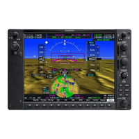
Garmin G1000 NXi Pilot's Manual (478 pages)
Cessna Nav III
Brand:
Garmin
| Category:
Avionics Display
| Size: 29.31 MB
Table of Contents
Table of Contents
11
Section 1 System Overview
15
System Description
15
Line Replaceable Units (LRU)
15
System Controls
18
PFD/MFD Controls
18
Secure Digital Cards
21
System Operation
22
System Power-Up
22
Normal Operation
23
Reversionary Mode
24
System Annunciations
25
System Status
27
ADAHRS Operation
28
AHRS Operation
29
GPS Receiver Operation
30
Accessing System Functionality
36
Softkey Function
36
Menus
41
Mfd Page Groups
42
System Settings
45
System Utilities
51
Display Backlighting
56
Section 2 Flight Instruments
57
Flight Instruments
60
Airspeed Indicator
60
SECTION 2 FLIGHT INSTRUMENTS 2.1 Flight Instruments
60
Attitude Indicator
62
Altimeter
63
Vertical Speed Indicator (VSI)
65
Vertical Deviation
65
Horizontal Situation Indicator (HSI)
67
Current Track Indicator
68
Selected Heading Bug
68
Course Deviation Indicator (CDI)
70
Course Deviation Indicator
70
Navigation Source
70
Supplemental Flight Data
77
Temperature Display
77
Wind Data
77
Generic Timer
78
Vertical Navigation (VNV) Indications
78
PFD Annunciations and Alerting Functions
80
Marker Beacon Annunciations
80
Altitude Alerting
80
Low Altitude Annunciation
81
Minimum Descent Altitude/Decision Height Alerting
81
Abnormal Operations
83
Abnormal GPS Conditions
83
Aircraft Symbol
83
Unusual Attitudes
84
Section 3 Engine Indication System
85
Engine Display
86
SECTION 3 ENGINE INDICATION SYSTEM 3.1 Engine Display
86
Engine Page
98
EIS Display (Reversionary Mode)
103
Section 4 Audio Panel and Cns
105
Overview
105
PFD Controls and Frequency Display
106
Audio Panel Controls
108
COM Operation
110
COM Tuning Boxes
110
COM Transceiver Manual Tuning
111
Auto-Tuning the COM Frequency
111
Frequency Spacing
114
NAV Operation
115
NAV Tuning Boxes
115
NAV Radio Selection and Activation
116
NAV Receiver Manual Tuning
116
Auto-Tuning a NAV Frequency from the MFD
117
Marker Beacon Receiver
119
DME Tuning
120
Mode S Transponder
121
Transponder Controls
121
Transponder Mode Selection
122
IDENT Function
124
Flight ID Reporting
125
Additional Audio Panel Functions
126
Power-Up
126
Mono/Stereo Headsets
126
Speaker
126
Intercom
126
Split COM
128
Clearance Recorder and Player
128
Entertainment Inputs
129
Audio Panels Preflight Procedure
130
Abnormal Operation
131
Stuck Microphone
131
COM Tuning Failure
131
Audio Panel Fail-Safe Operation
131
Reversionary Mode
131
Section 5 Flight Management
133
Introduction
133
Navigation Status Box and Data Bar
134
Using Map Displays
136
Map Orientation
136
Map Range
138
Map Panning
140
Measuring Bearing and Distance
142
Topography
143
Map Symbols
146
Airways
151
Additional Navigation Map Items
153
IFR/VFR Charts
156
Waypoints
159
Airports
160
Intersections
168
Ndbs
170
Vors
172
Vrps
174
User Waypoints
176
Airspaces
182
Direct-To-Navigation
186
Garmin G1000 NXi Reference Manual (260 pages)
Brand:
Garmin
| Category:
Car Navigation system
| Size: 5.99 MB
Table of Contents
Table of Contents
19
Flight Instruments
27
Enabling/Disabling or Modifying Individual Vspeed Reference Bugs
27
Enabling/Disabling Vspeed Reference Bugs as a Group or Restoring
27
All Default Settings
27
Selecting the Altitude Display Units
27
Setting the Selected Altitude
28
Enabling Altitude Units Overlays
28
Selecting the Altimeter Barometric Pressure Setting
28
Selecting Standard Barometric Pressure (29.92 in Hg)
28
Change Altimeter Barometric Pressure Setting Units
28
Setting the BARO QFE
29
Displaying the Metric Altitude Overlay
30
Setting Baro Transition Alerts
30
Change Navigation Sources
31
Enabling/Disabling the HSI Map on the PFD
31
Adjusting the Selected Heading
31
Adjusting the Selected Course
31
Changing the Navigation Angle True/Magnetic Setting
31
Selecting Bearing Display and Changing Sources
32
Changing the Selected GPS CDI Setting
32
Enable/Disable OBS Mode While Navigating with a GPS Flight Plan
32
Displaying the DME Information Window
33
Using the Generic Timer
33
Changing the Temperature Display Units
33
Displaying Wind Data
34
Setting the Baro Transition Alerts
34
Set Baro/Temp Comp Minimum Altitude Alert and Bug
35
Synthetic Vision
35
Configuring Field of View
36
Engine Indication
37
Engine Displays
37
Engine Page
50
Turbine Inlet Temperature
51
Exhaust Gas Temperature
51
Cylinder Head Temperature
51
Lean Engine Page
52
Fuel Calculations
53
Oil Pressure and Temperature Gauges
55
Fuel Quantity
55
Nav/Com/Transponder/Audio Panel
57
Enter or Change a Flight ID (Optional)
57
ADF Tuning (Optional)
57
DME Tuning (Optional)
57
Selecting Transponder Mode
57
Enter a Transponder Code
58
Selecting a COM Radio
58
Selecting a NAV Radio
58
NAV/COM Tuning
58
Auto-Tuning Radios on the PFD
59
Auto-Tuning from the MFD
59
Digital Clearance Recorder and Player
60
Intercom System (ICS) Isolation (GMA 1347)
60
Intercom System (ICS) Isolation (GMA 1360)
61
Audio (GMA 1360)
62
Blue-Select Mode (Telephone/Entertainment Distribution) (GMA 1360)
63
Bluetooth ® (GMA 1360)
63
Flight Management
65
Changing a Field in the MFD Navigation Status Box
65
Using Map Displays
65
Changing the Navigation Map Orientation
65
Enabling/Disabling Auto North up and Selecting the Minimum Switching Range
65
Configuring Automatic Zoom
66
Panning the Map
66
Reviewing Information for an Airport, NAVAID, or User Waypoint
67
Viewing Airspace Information for a Special-Use or Controlled Airspace
67
Measuring Bearing and Distance between any Two Points
67
Displaying/Removing Topographic Data on All Mfd Pages
67
Pages Displaying Navigation Maps
67
Displaying/Removing Topographic Data on the PFD Inset Map or the HSI Map
68
Displaying/Removing Topographic Data Using the
68
Map - Navigation Map' 'Page Menu' Window
68
Selecting a Topographical Data Range (Terrain Display)
68
Displaying/Removing the Topographic Scale (Topo Scale)
69
Setting up the 'Land', 'Aviation' or 'Airspace' Group Items
69
Decluttering the MFD Navigation Map
69
Decluttering the PFD Map
70
Displaying/Removing Airways
70
Selecting an Airway Range (Low ALT Airways or High ALT Airways)
70
Setting up Additional 'Map' Group Items
70
Waypoints
71
Selecting an Airport for Review by Identifier, Facility Name, or Location
71
Selecting a Runway
71
Viewing a Destination Airport
71
Viewing Information for a Nearest Airport on the PFD
72
Viewing Information for a Nearest Airport on the MFD
72
Viewing Runway Information for a Specific Airport
72
Selecting Nearest Airport Surface and Minimum Runway
73
Length Matching Criteria
73
Viewing Non-Airport Waypoints
73
Viewing Nearest Non-Airport Waypoints
73
Creating User Waypoints from the 'WPT - User WPT Information' Page
74
Creating a User Waypoint from the 'FPL - Active Flight Plan' Page
75
Creating User Waypoints from Map Pages
76
Editing a User Waypoint Comment or Location
77
Changing the User Waypoint Storage Duration Default Setting
77
Deleting a Single User Waypoint
77
Deleting All User Waypoints
77
Airspaces
78
Displaying and Removing Airspace Altitude Labels
78
Turning an Airspace Alert on or off
78
Changing the Altitude Buffer Distance Setting
78
Selecting and Viewing an Airspace Alert with Its Associated Information
79
Turning Smart Airspace on or off
79
Direct-To Navigation
79
Entering a Waypoint Identifier, Facility Name, or City as a Direct-To Destination
79
Selecting an Active Flight Plan Waypoint as a Direct-To Destination
80
Selecting a Nearest, Recent or User Waypoint as a Direct-To Destination
80
Selecting any Waypoint as a Direct-To Destination
81
Selecting a Nearby Airport as a Direct-To Destination
81
Selecting a Manual Direct-To Course
81
Reselecting the Direct Course from the Current Position
81
Selecting a Waypoint as a Direct-To Destination Using the Pointer
82
Cancelling a Direct-To
82
Flight Planning
82
Changing the Flight Plan View
82
Viewing Charts and 'FPL - Active Flight Plan' Page in Split Screen Mode
83
Page in Split Screen Mode
83
Creating an Active Flight Plan
83
Creating a Stored Flight Plan
84
Adding a Waypoint to the Active Flight Plan
85
Creating and Adding User Waypoints to the Active Flight
86
Plan Using the Map Pointer
86
Adding a Waypoint to an Existing Stored Flight Plan
86
Removing an Individual Waypoint from the Active Flight Plan
86
Removing an Individual Waypoint from a Stored Flight Plan
87
Designating a Fly-Over Waypoint
87
Adding an Airway to the Active Flight Plan
88
Adding an Airway to a Stored Flight Plan
88
Removing an Entire Airway from the Active Flight Plan
89
Removing an Entire Airway from a Stored Flight Plan
89
Collapse/Expand Airways in the Active Flight Plan
90
Activating a Flight Plan Leg
90
Entering an Along Track Offset Distance
90
Entering a VNV Altitude and Along-Track Offset for the Waypoint
91
Activating Parallel Track
91
Cancelling Parallel Track
92
Determining the Closest Point Along the Active Flight Plan
92
To a Selected Waypoint
92
Creating a User-Defined Hold at an Active Flight Plan Waypoint
92
Creating a User-Defined Hold at the Aircraft Present Position
93
Creating a User-Defined Hold at a Direct-To Waypoint
93
Exiting a User-Defined Hold Inserted into the Active Flight Plan
94
Removing a User-Defined Hold Inserted into the Active Flight Plan
94
Removing a User-Defined Hold at an Off-Route Direct-To
94
Ignoring a Flight Plan Transfer from a Wireless Connection
95
Previewing a Flight Plan Transfer from a Wireless Connection
95
Storing a Pending Flight Plan
95
Activating a Pending Flight Plan
95
Deleting a Pending Flight Plan
96
Deleting All Pending Flight Plans
96
Importing a Flight Plan from an SD Card
96
Exporting a Flight Plan to an SD Card
97
Inverting the Active Flight Plan
98
Deleting the Active Flight Plan
98
Viewing Information about a Stored Flight Plan
98
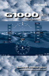
Garmin G1000 NXi Cockpit Reference Manual (270 pages)
Brand:
Garmin
| Category:
Autopilot System
| Size: 3.46 MB
Table of Contents
Table of Contents
19
Flight Instruments
25
Garmin SVT (Synthetic Vision Technology)
32
Supplemental Flight Data
34
PFD Annunciations and Alerting Functions
35
Engine Indication System
37
Nav/Com/Transponder/Audio Panel
39
COM Operation
39
NAV Operation
40
Mode S Transponders
41
Intercom System (ICS) (GMA 1347)
43
Intercom System (ICS) (GMA 1360)
43
Passenger Address (PA) System
45
Clearance Recorder and Player
45
Blue-Select Mode (GMA 1360)
45
Bluetooth ® Setup (GMA 1360)
46
Audio Panels Preflight Procedure
47
Flight Management
49
Introduction
49
Using Map Displays
49
Map Range
50
Map Panning
50
Measuring Bearing and Distance
51
Topography
52
Airways
54
Additional Navigation Map Items
54
Waypoints
55
Airports
55
Non-Airport Waypoints
57
Airspaces
63
Nearest Airspace
63
Smart Airspace
65
Direct-To-Navigation
65
Flight Planning
68
Flight Plan Views
68
Creating a Flight Plan
70
Flight Plan Waypoint and Airway Modifications
71
Flight Plan Operations
76
Closest Point of FPL
78
User-Defined Holding Patterns
78
Managing Flight Plans
80
Vertical Navigation
87
Altitude Constraints
88
Vertical Situation Display (VSD)
91
Procedures
91
Departures
92
Arrivals
95
Approaches
97
Trip Planning
105
Weight Planning
106
Raim Prediction
108
Sbas Selection
109
Hazard Avoidance
111
Data Link Weather
111
Activating Data Link Weather Services
111
Weather Product Age
113
Displaying Data Link Weather Products
116
Connext Data Requests
119
Weather Product Overview
121
FIS-B Weather Status
129
Stormscope Lightning Detection System
129
Using the Stormscope Page
129
Additional Stormscope Displays
130
Airborne Color Weather Radar
131
Basic Antenna Tilt and Range Setup
131
Weather Mapping and Interpretation
132
Ground Mapping and Interpretation
139
Additional Weather Radar Displays
140
Taws-B
141
Relative Terrain Symbology
141
TAWS-B Alerts
143
Vertical Situation Display (Vsd) Terrain
144
Taws-A
145
Relative Terrain Symbology
145
TAWS-A Page
146
TAWS-A Alerts
147
System Status
147
Tas/Tcas I Traffic
148
System Test
149
Operation
149
Ads-B Traffic
151
Traffic Description
152
Operation
153
ADS-B System Status
155
Tcas II Traffic
155
System Test
156
Operation
157
Automatic Flight Control System
161
Activating the Flight Director
161
Vertical Modes
162
Garmin G1000 NXi Cockpit Reference Manual (220 pages)
Diamond DA62 System Software Version 2056.10 or later
Brand:
Garmin
| Category:
Control Panel
| Size: 4.79 MB
Table of Contents
Table of Contents
19
Flight Instruments
25
Airspeed Indicator
25
Altimeter
26
Horizontal Situation Indicator (HSI)
27
Course Deviation Indicator (CDI)
28
Supplemental FLIGHT Data
29
Wind Data
29
Garmin Synthetic Vision Technology (SVT)
29
SVT Operation
29
Field of View
30
Pfd Annunciations and Alerting Functions
30
ENGINE Indication System (EIS)
31
EIS Display
31
ENGINE Page
32
Fuel Calculations
34
Audio Panel and CNS
35
Com Operation
35
Nav Operation
36
Nav Radio Selection and Activation
36
Adf/Dme Tuning
36
Mode S Transponder
37
Flight ID Reporting
38
Additional Audio Panel Functions
38
Intercom
38
Blue-Select Mode (Telephone/Entertainment Distribution)
39
Bluetooth
40
Audio Panel PREFLIGHT Procedure
40
FLIGHT Management
43
Navigation Status Box and Data Bar
43
USING Map Displays
43
Map Orientation
43
Map Range
44
Map Panning
44
Measuring Bearing and Distance
45
Topography
45
Map Symbols
46
Airways
47
Additional Navigation Map Items
48
Waypoints
49
Airports
49
Non-Airport Waypoints
50
Nearest Airspace
54
Smart Airspace
54
Direct-To-Navigation
55
FLIGHT Planning
57
Flight Plan Views
57
Creating a Flight Plan
57
Flight Plan Waypoint and Airway Modifications
58
Flight Plan Operations
63
Managing Flight Plans
66
Vertical Navigation
73
Constraints
74
Vertical Situation Display (Vsd)
76
Vertical Navigation Direct to
77
Departures
78
Arrivals
80
Approaches
82
TRIP Planning
87
Raim (RECEIVER Autonomous Integrity Monitoring) Prediction
88
Hazard Avoidance
91
Data LINK Weather
91
Activating the Siriusxm Weather Service
91
Weather Product Age
93
Displaying Data Link Weather Products
95
Connext Weather Data Requests
98
Weather Product Overview
99
FIS-B Weather Status
107
Stormscope ® LIGHTNING Detection System
107
Using the Stormscope Page
107
Additional Stormscope Displays
108
Stormscope Abnormal Operations
109
Airborne Color Weather Radar
110
Basic Antenna Tilt and Range Setup
110
Weather Radar Operation
113
Ground Mapping and Interpretation
116
Additional Weather Radar Displays
117
Terrain Displays
118
Vertical Situation Display (Vsd) Terrain
119
Traffic Information SERVICE (TIS)
120
Displaying Traffic Data
121
Avidyne Tas600 Traffic
122
System Test
124
Operation
124
Ads-B Traffic
126
Operation
127
Garmin G1000 NXi Supplemental Maintenance Manual (171 pages)
Brand:
Garmin
| Category:
GPS
| Size: 4.09 MB
Table of Contents
Table of Contents
4
Content, Scope, Purpose
9
Introduction
9
Organization
10
Definitions/Abbreviations
11
Publications
12
Table 1-1, Required Documents
12
Units of Measure
12
Revision and Distribution
13
Section 1 1-1 –
13
Table 1-2, Reference Publications
13
Figure 3-11, Stormscope Configuration Page
59
Figure 3-12, Stormscope Configuration
59
Section 3 3-1 –
60
Servicing Information
62
Maintenance Intervals
64
Table 4-1, Maintenance Intervals
64
Electrical Bonding Test
65
G1000 Redundant Connection Check
66
GSU 75 Earth Magnetic Field Updates
66
Section 4 4-1–
68
Figure 5-1, aux - System Status Page
69
Troubleshooting
69
Figure 5-2, System Annunciations
70
System Annunciations
70
Figure 5-3, Alerts & Annunciations
80
Figure 5-4, Alerts Softkey Annunciation
80
G1000 Alerting System
80
Table 5-1, SVS Troubleshooting
81
Backup Communications Path Checks
82
Table 5-2, SVS-Related Alert Messages
82
GDU 105X Troubleshooting
83
GDU 105X Alerts
85
GTX Troubleshooting
89
GDL69A SXM Troubleshooting (if Installed)
90
GSU 75 and GMU 44 Troubleshooting
91
Figure 5-5, Magnetometer Interference Test
93
Table 5-3, Magnetometer Interference Test Sequence
94
GSU 75 Troubleshooting
95
Software/Configuration Troubleshooting
96
Backshell/Backplate Connectors
98
Synthetic Vision and Pathways Troubleshooting
81
Equipment Descriptions
14
System Description
14
Figure 2-2, Transponder
15
Figure 2-3 GSU-75 ADAHRS with Connector and Mounting Tray
16
Figure 2-4, GDL 69A SXM Datalink
17
Figure 2-5, G1000 Softkeys
18
Figure 2-6, Normal Mode
19
Reversionary Mode
20
G1000 Normal Mode
19
Electrical Power Distribution
18
FMS Knob
18
G1000 Optional Interfaces
18
GDU 1054B and GDU 1050 Displays
18
Pitot/Static System
18
Softkeys
18
Figure 2-7, Automatic Reversion with MFD Failure
20
Section 2 2-1 –
20
Configuration Mode Overview
21
Software and Configuration
21
Figure 3-1, SET>ACTV Diagram
22
Figure 3-2, Loss of Communication
23
Figure 3-3, Configuration Status
23
Figure 3-4, Data Transmission Indicators
23
Figure 3-5, GSU Configuration Settings Storage
33
Configuration Mode
34
Equipment Verification (Third Party/Optional Equipment Documentation)
34
G1000 Hardware/Software Compatibility Check
34
Figure 3-6, Garmin Unit S/N Location
35
Table 3-1, Garmin Unit S/N Prefixes
35
Figure 3-7, Software/Configuration Overview
36
System Software and Configuration Load
37
Figure 3-8 - Airframe Group Selection
38
Figure 3-9 - Airframe Change Confirmation
39
Feature Enablement
51
Aircraft Registration Number Entry
54
Configuration Manager
55
Database Loading
56
Splash Screen Loading
56
Figure 3-10, MFD aux - Database Page DB Transfer
57
Clearing Default User Settings
58
Configuration of Navigation Map for Traffic System
58
Interface Confirmation
59
G1000 Software/Configuration Procedure
36
G1000 System Software Information
26
Figure 5-6, GTX 335R/345R Looking at Front of Connector (P3251)
98
Figure 5-7, GTX 345R (Only) Looking at Front of Connector (P3252)
98
Figure 6-1, Configuration Module Installation
103
Table 6-1, Configuration Module Kit - 011-00979-00
103
Figure 6-2, GSU 75 Configuration Module Installation
104
Table 6-2, GSU 75 Configuration Module Kit - 011-00979-20
104
Section 6 6-1 –
105
Garmin G1000 Lru Replacement/Configuration & Testing
106
Gdu 1054B/1050 Pfd & Mfd
106
Figure 7-1, G1000 Normal Mode Check
108
Figure 7-2, aux - GPS Status Page (MFD)
119
GEA 71 Engine/Airframe Unit
122
Figure 7-3, Normal Engine Instrument Markings (MFD)
125
GTX 335R, GTX 345R, or GTX 33 Transponder
126
Figure 7-4, Aircraft Registration
128
GSU 75 ADAHRS (if Installed)
129
GDC 74A Air Data
131
GMA 1347 Audio Panel
109
GIA 63W Integrated Avionics Unit
113
Table 7-1, Altitude Test Points
133
Table 7-2, Airspeed Test Points
134
Table 7-3, Vertical Speed Table
134
GRS 77 and GMU 44 Magnetometer (if Installed)
135
GMU 44 Magnetometer
137
GSU/GRS/GMU Calibration Procedures
138
Table 7-4, Required GRS/GMU Calibrations
139
Figure 7-5, GRS/GMU Calibration, Pitch/Roll Offset
140
Figure 7-6, GRS/GMU Calibration, Engine Run-Up
144
Figure 7-7, Normal Mode AHRS Check
146
GDL 69A or GDL 69A SXM Data Link (if Installed)
147
GSA 81 Servos (if Installed)
149
Garmin Traffic Systems (GTS 800) (if Installed)
151
Section 7 7-1–
154
Flitecharts Functional Check
155
Stormscope Functional Check (if Installed)
155
Subsystem Functional Checks
155
TAWS Functional Check
155
Chartview Functional Check
156
Safetaxi Functional Check
157
ADF Functional Check
158
DME Functional Check
158
Figure 8-1, Traffic Map
158
GTS Traffic System Functional Check
158
Search and Rescue Functional Check (if Installed)
160
Section 8 8-1 –
160
Display Test
161
Figure 9-1, MFD Power up Page
161
G1000 System Return to Service Procedure
161
Figure 9-2, PFD Power-Up System Annunciations
162
Figure 9-3, PFD Normal Operation
163
Figure 9-4, GDU Reversionary Mode
165
Figure 9-5, AUX-GPS Status Page
166
GPS Signal Acquisition
166
GPS Failure Test
167
GIA Failure Test
168
GEA Functional Check
169
G1000 Backup Path Test
170
Maintenance Records
170
Display Failure Test
164
Reversion Mode Check
165
Figure 5-10, GDL 69A SXM Backplate Connector (P69A1)
99
Figure 5-8, GDU 1054B/1050 Backshell Connector (P10401)
99
Figure 5-9, GSU 75 Connector View from Front (P751)
99
Section 5 5-1 –
99
Equipment Removal & Installation
100
Gdu 1054B/1050
101
GSU 75 ADAHRS (if Installed)
101
GTX 335R/GTRX 345R Transponder (if Installed)
101
Configuration Modules
102
GDL 69A SXM (if Installed)
102
Garmin G1000 NXi Supplemental Maintenance Manual (109 pages)
Brand:
Garmin
| Category:
Avionics Display
| Size: 3.18 MB
Table of Contents
Table of Contents
4
Introduction
7
Content, Scope, Purpose
7
Organization
8
Equipment Removal & Installation
8
Garmin G1000 Lru Replacement/Configuration & Testing
8
Subsystem Functional Checks
8
G1000 System Return to Service Procedure
8
Definitions/Abbreviations
9
Units of Measure
10
Publications
10
Table 1-1, Required Documents
10
Revision and Distribution
11
Table 1-2, Reference Publications
11
System Description
12
Equipment Descriptions
12
Figure 2-1 Flight Stream 510
12
Figure 2-2, GTX 345R/GTX 335R Transponder
13
Figure 2-3, GDL 69A SXM Datalink
13
G1000 Optional Interfaces
14
Electrical Power Distribution
14
Pitot/Static System
14
GDU 1050 and GDU 1055 Displays
14
Softkeys
14
FMS Knob
14
Figure 2-4, G1000 Softkeys
14
G1000 Normal Mode
15
Figure 2-5, Normal Mode
15
Reversionary Mode
16
Figure 2-6, Automatic Reversion with MFD Failure
16
Software and Configuration
17
Configuration Mode Overview
17
Figure 3-1, SET>ACTV Diagram
18
Figure 3-2, Loss of Communication
19
Figure 3-3, Configuration Status
19
Figure 3-4, Data Transmission Indicators
19
G1000 System Software Information
21
Configuration Mode
28
G1000 Hardware/Software Compatibility Check
29
Equipment Verification (Third Party/Optional Equipment Documentation)
30
Figure 3-5, Garmin Unit S/N Location
30
G1000 Software/Configuration Procedure
31
Figure 3-6, Software/Configuration Overview
31
System Software and Configuration Load
32
Figure 3-7, Airframe Change Confirmation
33
Feature Enablement
44
Aircraft Registration Number Entry and Flight ID Configuration
47
3.10 Configuration Manager
48
3.11 Splash Screen Loading
48
3.12 Database Loading
49
3.13 Clearing Default User Settings
51
3.14 Interface Confirmation
52
Figure 3-9, Stormscope Configuration Page
52
Figure 3-10, Stormscope Configuration
52
3.15 Flight Stream 510 Firmware Review
53
Servicing Information
56
Maintenance Intervals
58
Electrical Bonding Test
58
Table 4-1, Maintenance Intervals
58
G1000 Redundant Connection Check
60
Troubleshooting
62
Related Products
Garmin G1000H
Garmin G1000:Piper
Garmin G1000:Socata
Garmin G1000 NAV III
Garmin G1000 Diamond DA62
Garmin GNC 430A
Garmin GDL 49
Garmin GSU 75 Series
Garmin GSU 75B
Garmin GRS 77
Garmin Categories
GPS
Watch
Car Navigation system
Avionics Display
Marine GPS System
More Garmin Manuals