beautypg.com
Manuals
Brands
Garmin Manuals
GPS
GNS 480
Garmin GNS 480 Manuals
Manuals and User Guides for Garmin GNS 480. We have
8
Garmin GNS 480 manuals available for free PDF download: Installation Manaul, Installation Manual, Pilot's Manual, Quick Reference, Supplemental Flight Manual, User Newsletter
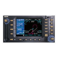
Garmin GNS 480 Pilot's Manual (162 pages)
color GPS/WAAS/NAV/COM
Brand:
Garmin
| Category:
GPS
| Size: 7.9 MB
Table of Contents
Introduction
3
Cautions
3
Accessories and Packing List
4
Welcome
5
Preface
5
About this Manual
5
Table of Contents
6
Getting Started
9
Controls
10
Datacard
12
Display
13
Using the Moving Map
14
Annunciations
19
Starting up
21
Set Fuel Full and Reserve
21
Self-Tests
21
Database Check
21
View Checklists
22
View Messages
22
Set Com and Nav Frequencies
22
Using the Remote Transponder
23
Change the Transponder (Squawk Code) - Two Methods
23
Transponder Options
23
Nav Terms Diagram
24
Flight Plan Terms Diagram
24
Create a New Flight Plan (Quick Method)
25
Select a Direct-To a Waypoint in Your Flightplan
25
Find a Nearest Waypoint
26
Find a Nearest Waypoint Frequency
26
Inserting Terminal Procedures and Approaches . 19 Perform a RAIM Prediction
27
Moving Map Mode (MAP)
28
True North
28
Moving Map Mode Menu Items
29
GNS 480 Map Mode Nav Data Options
30
Basic Operation
32
Nav/Hsi Display (NAV)
39
Panning (PAN)
41
Range
41
Create a New User Waypoint
41
Direct-To
42
Actfp
42
Direct
42
Inserting a Hold at a Waypoint in the Active Flight Plan
43
Destination (Dest)
43
Course-To (Crsto)
44
Course from (Crsfr)
44
Obs
45
OBS to a Waypoint in Your Flight Plan
45
OBS to a Waypoint Not in Your Flight Plan
46
Flyleg
46
Nearest (NRST) Search
47
Search Around a Reference Point (SRCH)
47
Nearest Frequency
47
FSS and ARTCC Frequencies
48
Info on Nearest Waypoint
48
Fly Direct-To a Nearest Waypoint
48
Using the NRST Function to Change Your Destination to a Nearest Airport
49
Search for All Nearest Airports/Helipads
49
Information on Waypoints (INFO)
50
Airport Information
50
Airport Frequency Information
51
VOR Information
52
NDB Information
52
Airway Intersection Information
52
RAIM Prediction
53
Com Radio (COM)
54
Squelch (SQ)
54
Tx/Rx
54
Monitor (MON)
54
Recall (RCL)
54
Recent
54
User
55
Emergency
55
Flip/Flop
55
Signal
55
Weather
55
Audio
56
Save Channel
56
Nav Radio (VOR)
57
DME Distance
57
Monitor (MON)
57
Recall (RCL)
58
Flip/Flop
58
ID/To/Fr
58
Back Course
58
Audio
58
User
58
Save Channel
58
Test Log
59
Transponder Control (XPDR)
60
Ident
60
Standby
60
Alt
60
Transponder Line Selection Keys
60
Emergency
60
Vfr
61
Trgrspd
61
Auto
61
Flight ID
61
Ground
62
Manually Select a Squawk Code
62
Flight Planning (FPL)
63
Active Flight Plan
63
Modified Flight Plan
63
Remote Flight Plan
63
Library Flight Plan
64
Flight Plan Functions
64
View
64
Back
64
Edit
64
Expand (XPND)
64
Cross Link (X-Link)
65
Remote Flight Plans
65
Reverse (Rvrse)
65
Save
65
Edit
66
Execute (Exec)
66
Comment (Cmnt)
66
Copy
66
Discontinuity
67
Pilot Nav Legs
67
Searching for Waypoints to Insert into a Flight Plan
68
Activate a Flight Plan
69
Delete the Active Flight Plan
69
Edit a Flight Plan
69
Changing Origin, Destination, & Alternate Waypoints
69
Inserting a Waypoint or Airway in Your Flight Plan
69
Deleting a Waypoint or Airway in Your Flight Plan
70
Steps for Setting up a Simple Flight Plan
70
Steps for Setting up a Flight Plan Using Terminal Procedures and Airways
70
Set Origin, Destination, and Alternate Waypoints
71
Add a Standard Instrument Departure (SID) Procedure
71
Insert en Route Flight Plan Airways And/Or Waypoints
72
Modifying a Flight Plan While in Flight
72
Add Arrival Procedures (STARS)
73
Add Approach Procedures
73
Leg Types
74
Turn Short Path Calculation
74
Procedures
83
Selecting Procedures
83
Activating an Approach
83
Steps for Approach Operations
84
Basic Approach Operations Examples
84
Approaches with Procedure Turns
85
Flying the Procedure Turn
86
Flying the Missed Approach
88
Flying an Approach with a Hold
89
Flying a DME Arc Approach
92
Vectors to Final
95
Flying a Vectored Approach
96
ILS Approaches
98
Selecting an ILS Approach
99
Flying the ILS Approach
100
Selecting an LPV Approach
104
Flying the LPV Approach
104
Flying the LP Approach
105
RNAV Approach Procedures
107
Timers (TMR)
111
Timer 1 and Timer 2
111
Trip Time and Distance
111
Flight Time and Distance
112
Trigger Speed
112
Checklist (CHK)
113
Creating a New or Editing an Existing Checklist
113
Using Your Checklist
113
Move a Checklist
114
User Waypoints (USER)
117
Creating or Editing a User Waypoint
117
Searching for a User Waypoint
117
System Mode (SYS)
118
GPS Status
118
Software Versions
118
Configuration
119
Barometric Correction
119
Barometric Pressure Units
119
Magnetic Variation Selection
120
Magnetic Variation Degree Value
120
CDI Scale
120
Ils CDI
121
Distance Units
121
Altitude Units
121
Fuel Type
122
Fuel Units
122
Fuel Full Amount
122
Fuel Low Message
123
Display Brightness Selection
123
Minimum Brightness Value
124
Message Tone
124
Airspace Alerts
124
Owner Information
125
Aircraft Icon
125
VFR Squawk
125
Enable SBAS Providers
126
Parallel Track (PTK)
127
Simulator Mode
129
Automatic Track (ATK)
129
Manual Track
129
Present Position (PPOS)
130
Airspeed
130
Messages (MSG)
131
Text Messages
131
Audio Messages
136
Setting Message Audio Level
136
Traffic (TFC)
137
Traffic Display Range Ring
137
Traffic Symbols
137
Traffic Pop-Up
138
No-Bearing Traffic Advisories (Skywatch Only)
138
Vertical Display Modes
139
Operate/Standby
139
Test
139
Traffic in Map Mode
140
Traffic Annunciations
140
Specifications
141
Physical Specifications
141
Power
141
Environmental
141
GPS Performance
141
VHF Comm Performance
141
VOR Performance
141
Localizer Performance
141
Glideslope Performance
141
Care Information
142
Cleaning the Unit
142
Battery Replacement
142
Display Backlight
142
Garmin Data Cards
143
Installing and Removing Data Cards
143
Appendix
143
Contacting the Factory
144
Glossary
145
Waas
152
Safety Information
152
What Is WAAS
152
Compliance, License, and Warranty Information
153
FCC Compliance
153
Canadian RF Exposure and Compliance
154
Software License Agreement
155
Product Registration and Support
155
Limited Warranty
156
Index
157
Garmin GNS 480 Pilot's Manual (160 pages)
color GPS/WAAS/NAV/COM
Brand:
Garmin
| Category:
GPS
| Size: 9 MB
Table of Contents
Introduction
3
Cautions
3
Accessories and Packing List
4
Welcome
5
Preface
5
About this Manual
5
Table of Contents
6
Getting Started
9
Controls
10
Datacard
12
Display
13
Using the Moving Map
14
Annunciations
19
Starting up
21
Set Fuel Full and Reserve
21
Self-Tests
21
Database Check
21
View Checklists
22
View Messages
22
Set Com and Nav Frequencies
22
Using the Remote Transponder
23
Change the Transponder (Squawk Code) - Two Methods
23
Transponder Options
23
Nav Terms Diagram
24
Flight Plan Terms Diagram
24
Create A New Flight Plan (Quick Method)
25
Select a Direct-To a Waypoint in Your Flightplan
25
Select a Direct to Waypoint Not in Your Flightplan
25
Find a Nearest Waypoint
26
Find a Nearest Waypoint Frequency
26
Inserting Terminal Procedures and Approaches . 19 Perform a RAIM Prediction
27
Moving Map Mode (MAP)
28
True North
28
Moving Map Mode Menu Items
29
GNS 480 Map Mode Nav Data Options
30
Basic Operation
32
Nav/Hsi Display (NAV)
39
Panning (PAN)
41
Range
41
Create a New User Waypoint
41
Direct-To
42
Actfp
42
Direct
42
Inserting a Hold at a Waypoint in the Active Flight Plan
43
Destination (Dest)
43
Course-To (Crsto)
44
Course from (Crsfr)
44
Obs
45
OBS to a Waypoint in Your Flight Plan
45
OBS to a Waypoint Not in Your Flight Plan
46
Flyleg
46
Nearest (NRST) Search
47
Search Around a Reference Point (SRCH)
47
Nearest Frequency
47
FSS and ARTCC Frequencies
48
Info on Nearest Waypoint
48
Fly Direct-To a Nearest Waypoint
48
Using the NRST Function to Change Your Destination to a Nearest Airport
49
Information on Waypoints (INFO)
50
Airport Information
50
Airport Frequency Information
51
VOR Information
52
NDB Information
52
Airway Intersection Information
52
RAIM Prediction
53
Com Radio (COM)
54
Squelch (Sq)
54
Tx/Rx
54
Monitor (MON)
54
Recall (RCL)
54
Recent
54
User
55
Emergency
55
Flip/Flop
55
Signal
55
Weather
55
Audio
56
Save Channel
56
Nav Radio (VOR)
57
DME Distance
57
Monitor (MON)
57
Recall (RCL)
58
Flip/Flop
58
ID/To/Fr
58
Back Course
58
Audio
58
User
58
Save Channel
58
Test Log
59
Transponder Control (XPDR)
60
Ident
60
Standby
60
Alt
60
Transponder Line Selection Keys
60
Emergency
60
Vfr
61
Trgrspd
61
Auto
61
Flight ID
61
Ground
62
Manually Select a Squawk Code
62
Flight Planning (FPL)
63
Active Flight Plan
63
Modified Flight Plan
63
Remote Flight Plan
63
Library Flight Plan
64
Flight Plan Functions
64
View
64
Back
64
Edit
64
Expand (XPND)
64
Cross Link (X-Link)
65
Remote Flight Plans
65
Reverse (Rvrse)
65
Save
65
Edit
66
Execute (Exec)
66
Comment (Cmnt)
66
Copy
66
Discontinuity
67
Pilot Nav Legs
67
Searching for Waypoints to Insert into a Flight Plan
68
Activate a Flight Plan
69
Delete the Active Flight Plan
69
Edit a Flight Plan
69
Changing Origin, Destination, & Alternate Waypoints
69
Inserting a Waypoint or Airway in Your Flight Plan
69
Deleting a Waypoint or Airway in Your Flight Plan
70
Steps for Setting up a Simple Flight Plan
70
Steps for Setting up a Flight Plan Using Terminal Procedures and Airways
70
Set Origin, Destination, and Alternate Waypoints
71
Add a Standard Instrument Departure (SID) Procedure
71
Insert en Route Flight Plan Airways And/Or Waypoints
72
Modifying a Flight Plan While in Flight
72
Add Arrival Procedures (STARS)
73
Add Approach Procedures
73
Leg Types
74
Turn Short Path Calculation
74
Procedures
83
Selecting Procedures
83
Activating an Approach
83
Steps for Approach Operations
84
Basic Approach Operations Examples
84
Approaches with Procedure Turns
85
Flying the Procedure Turn
86
Flying the Missed Approach
88
Flying an Approach with a Hold
89
Flying a DME Arc Approach
92
Vectors to Final
95
Flying a Vectored Approach
96
ILS Approaches
98
Selecting an ILS Approach
99
Flying the ILS Approach
100
Selecting an LPV Approach
104
Flying the LPV Approach
104
Flying the LP Approach
105
LPV, LNAV/VNAV, LNAV+V, and LNAV Approaches with Advisory Vertical Guidance
107
Timers (TMR)
110
Timer 1 and Timer 2
110
Trip Time and Distance
110
Flight Time and Distance
111
Trigger Speed
111
Checklist (CHK)
112
Creating a New or Editing an Existing Checklist
112
Using Your Checklist
112
Move a Checklist
113
User Waypoints (USER)
116
Creating or Editing a User Waypoint
116
Searching for a User Waypoint
116
System Mode (SYS)
117
GPS Status
117
Software Versions
117
Configuration
118
Barometric Correction
118
Barometric Pressure Units
118
Magnetic Variation Selection
119
Magnetic Variation Degree Value
119
CDI Scale
119
Ils CDI
120
Distance Units
120
Altitude Units
120
Fuel Type
121
Fuel Units
121
Fuel Full Amount
121
Fuel Low Message
122
Display Brightness Selection
122
Minimum Brightness Value
123
Message Tone
123
Airspace Alerts
123
Owner Information
124
Aircraft Icon
124
VFR Squawk
124
Enable SBAS Providers
125
Parallel Track (PTK)
126
Simulator Mode
128
Automatic Track (ATK)
128
Manual Track
128
Present Position (PPOS)
129
Airspeed
129
Messages (MSG)
130
Text Messages
130
Audio Messages
134
Setting Message Audio Level
135
Traffic (TFC)
136
Traffic Display Range Ring
136
Traffic Symbols
136
Traffic Pop-Up
137
No-Bearing Traffic Advisories (Skywatch Only)
137
Vertical Display Modes
138
Operate/Standby
138
Test
138
Traffic in Map Mode
139
Traffic Annunciations
139
Specifications
140
Physical Specifications
140
Power
140
Environmental
140
GPS Performance
140
VHF Comm Performance
140
VOR Performance
140
Localizer Performance
140
Glideslope Performance
140
Care Information
141
Cleaning the Unit
141
Battery Replacement
141
Display Backlight
141
Appendix
141
Garmin Data Cards
142
Installing and Removing Data Cards
142
Glossary
144
Waas
151
Safety Information
151
What Is WAAS
151
Compliance, License, and Warranty Information
152
FCC Compliance
152
Software License Agreement
153
Product Registration and Support
153
Limited Warranty
154
Index
156
Garmin GNS 480 Installation Manaul (200 pages)
Color GPS/NAV/COM
Brand:
Garmin
| Category:
GPS
| Size: 5.73 MB
Table of Contents
Installation Manual
1
Guide*
3
Table of Contents
5
Appendix A - Certification Data
11
Appendix B - Serial Interface Specifications
11
Ompatibility
11
Equipment Description
12
Features
12
Gns 480 Color
12
Olor Gps/Nav/Com
12
System Interfaces
13
Figure 1-2. Sample Single
13
Figure 1-3. Sample Dual
14
S Ystems
14
B Aro C Orrection
15
Specifications
16
Electrical
16
Physical
16
Environmental
16
Display
17
Gps/Waas Receiver
17
Com Receiverp
18
Com Transmitterp
18
Nav Receiverp
19
Avionics Interfaces
20
W Ithout O Perational L Imitations
22
Serial Interface
23
W Ith O Perational L Imitations
23
Regulatory Compliance
24
Tso/Etso/Jtso a
25
Tso Deviations
26
Fcc Grant Ofe
26
Gns 480 Stc a
26
C Onfiguration
26
Database Updates
27
Unpacking the Equipment
27
Package Contents
28
Optional Accessories
29
Gps Antenna Options
29
Gps Antenna Doubler
30
Definitions & Acronyms
31
License Requirements
31
Optional Reference M
31
1 General Information
11
About this Manual
11
Manual Organization
11
Scope
11
2 Installation
33
Pre -Installationi
33
Installation Overview
33
Materials Not Supplied
33
Special Tools Required
34
Installation C
34
Minimum Systemc
34
T Ool for P/N 162-0082
34
E Valuation
35
Existing Sensors
36
Mounting Considerations
37
Figure 2-1. Acceptable Field
38
Of-View
38
Figure 2-2. Acceptable
39
Cabling and Wiring
40
Air Circulation and
40
Viewing Angle
40
Mounting Tube Installation
42
Gns 480 D
44
Unit Insertion
45
Figure 2-4. Typical Mounting
45
Rack
45
Unit Removal
46
Unit Replacement
46
Figure 2-5. Cam Lockp
46
Figure 2-6. Mounting Frame
47
A Ssembly
47
Electrical Connections
48
Interface Connector Definition
49
Figure 2-7. Rear Mounting
49
T Ube C Onnector L Ayout
49
Figure 2-8. 37-Pin Connector
50
Onnector P in -O Ut (P1)
50
Onnector P in -O Ut (P4)
51
Xpansion C Onnector P in -O Ut (P5)
52
Detail
54
Onnector P in -O Ut (P7)
55
Functional Descriptions
56
Power
56
Main Course Deviation Indicator
56
Auxiliary Course Deviation Indicator
58
Composite Indicator
58
Altimeter
59
Synchro Heading
59
Annunciator Outputs
60
Discrete Outputs
63
Switches / Discrete Inputs
63
Serial Interfaces
66
Nput L Abels
67
Utput L Abels
69
Time Mark Output
71
Vhf Com
71
Vhf Nav
72
Message Audio
72
Rmi / Obi
72
Dme Tuning
73
Antenna Installation and Connections
74
Com Antenna
74
Gps Antenna
74
Gps Antennai
75
Ntenna I Nstallation C Onsiderations
76
Nav Antenna
77
Weight and Balance
77
Figure 2-12 - Rear Coaxc
77
Ear C Oax C Onnector a Ssembly
77
Electrical Load Analysis
78
Nit W Eights
78
Enter of G Ravity
79
Gns 480 Center of
79
3 Post Installation Configuration & Checkout Procedures
81
Mounting and Wiring Check
81
Equipment Setup and Configuration
82
Figure 3-1. Groundm
82
Figure 3-2. Serial Ports
83
Setup Function
83
Arinc 429 Ports
85
Figure 3-4. Resolveri
86
Figure 3-5. Resolverc
87
Figure 3-6. Altimeteri
88
Figure 3-7. Baro -Altimeter
88
Com Radio Setup
89
Figure 3-10. Measurement of
90
Figure 3-9. Miscellaneous
90
Figure 3-11. Gps Vertical
91
Equipment Operational/Functional Test
99
Gns 480 Checkout Utilities
99
System Checkout - Ground Checks
110
Ground Check
110
System Checkout - Flight Checks
122
Flight Check
122
Database Check
123
Data Card Replacement
123
Afms Update
123
Gns 480 Post -I
125
Iscrete Nputs
125
Ystem
126
4 Troubleshooting
127
Troubleshooting Procedure
127
Contacting the Factory for Assistance
130
5 Limitations
131
Operation
131
Tso-C146 Agps/Waas Limitations
131
Installation
132
Gps Antenna
132
Ntenna Nstallation Eneral
132
Equipment Interfaced to the Gns 480
132
Preservation of Previous Systems
132
Aircraft Radio Station License
132
6 Periodic Maintenance
133
Equipment Calibration
133
Vor Checks
133
S Pecifications
137
Data.
138
Message Data ( Format)
140
Message Data (Z Format)
142
Avigation D Ata
145
List Data
147
Aypoint T Ype
148
A Vionics
155
Optional
156
M Inimum
159
M Ounting
167
F Igure D-6. Gns
169
F Igure D-14. Gns
185
F Igure D-15. Gns
187
F Igure D-16. Gns
189
A-33 and A33W a Ntennas
197
Garmin GNS 480 Installation Manual (186 pages)
color gps/nav/com
Brand:
Garmin
| Category:
GPS
| Size: 4.16 MB
Table of Contents
Installation Manual
1
Table of Contents
5
1 Eneral Nformation
11
Scope
11
Equipment Description
12
Features
12
Gns 480 Color
12
System Interfaces
13
Figure 1-2 - Sample Single
13
Figure 1-3 - Sample Dual
14
Specifications
16
Electrical
16
Physical
16
Environmental
16
Display
17
Gps/Waas Receiver
17
Comm Receiverp
18
Comm Transmitter
18
Nav Receiverp
19
Avionics Interfaces
20
Serial Interface
24
Regulatory Compliance
24
Tso/Jtso Authorization
25
Fcc Grant Ofe
25
Gns 480 Stc a
25
Database Updates
25
Tso Authorization
25
D-16
25
Unpacking the Equipment
26
Package Contents
27
Table 1-3 - Package Contents
27
Table 1-4 - Installation Kit
27
License Requirements
28
Table 1-5 - Hardware Kitc
28
Table 1-6 - Optional Equipment
28
Definitions & Acronyms
29
Nstallation
31
2 Installation
31
Installation Overview
31
Materials Required
31
Optional Accessories
32
Installation Considerations
32
Table 2-1 - Crimp Tool for Table 2-2 - Crimp Tool for
32
Existing Sensors
34
Mounting Considerations
35
Figure 2-1 - Acceptablef
36
Figure 2-2 - Acceptable
37
Air Circulation and 2.5.6 Compass Safe Distance
38
Cabling and Wiring
38
Helicopter Installation
38
Viewing Angle
38
Mounting Tubei
39
Gns 480 D
41
Figure 2-4 - Typical Mounting
42
Unit Insertion
42
Figure 2-5 - Cam Lockp
43
Unit Removal
43
Unit Replacement
43
Figure 2-6 - Mounting Frame
44
Electrical Connections
45
Table 2-3 - Interfacec
45
Table 2-4 - Crimp Contacts
45
Figure 2-7 - Rear Mounting
46
Interface Connector
46
Figure 2-8 - 37-Pin Connector
47
Table 2-5 Main Systemc
47
Com I/O Connector
48
Table 2-7 I/O Expansionc
49
Nav I/O Connector
52
Functional Descriptions 2.8.1 Power
53
Main Course Deviation
53
Composite Indicator
56
Altimeter
56
Synchro Heading
56
Annunciator Outputs
57
Discrete Outputs
60
Switches / Discrete
61
Serial Interfaces
62
Arinc 429 Input
64
Arinc 429 O
65
Vhf Com
67
Table 2-10A11 - Arinc 429 O
67
Vhf Nav
68
Message Audio
69
Rmi / Obi
69
Dme Tuning
70
Comm Antenna
71
Gps Antenna
71
Nav Antenna
72
Figure 2-11 - Rear Coaxc
72
Eight and Alance
73
Electrical Load Analysis
73
Table 2-12 - Unit Weights
73
Table 2-13 - Unit Powerl
73
W Eight and B Alance
73
Gns 480 Center of
74
Mounting and 3.2 Equipment Setup and C
75
Figure 3-1 - Groundm
76
Figure 3-2 - Serial Ports
76
Table 3-1 - Serial Port Setup
77
3.2.1.2 ARINC 429 Ports
78
Figure 3-4 - Resolveri
79
Figure 3-5 - Resolverc
80
Alibration
81
Figure 3-6 - Altimeteri
81
Figure 3-7 - Baro -Altimeter
81
Figure 3-8 - Com Radio Setup
82
Figure 3-10 - Measurement of
83
Figure 3-9 - Miscellaneous
83
Gps V Ertical O Ffset
83
Figure 3-11 - Gps Vertical
84
Page (GTX 33/330 Only)
90
3 Post Installation Configuration & Checkout Procedures
75
Equipment Operational
93
Figure 3-19 - Main CDI Flag
94
Figure 3-20 - Auxiliary CDI F
94
Figure 3-21 - Main CDI Test
95
Figure 3-22 - Auxiliary VDI T
96
Figure 3-23 - Lamp Outputt
97
Figure 3-24 - Display Testi
98
Figure 3-25 - Bezel Key Test
99
Figure 3-26 - Autopilot Test
100
Figure 3-27 - Interfacem
101
Figure 3-28 - Interfacem
101
Function Display - Page
101
Figure 3-29 - Interfacem
102
Function Display - Page
102
System Checkout - G
104
Database Check
116
Data Card Replacement
116
4 Troubleshooting
119
Troubleshootingp
119
Contacting Thef
122
5 Limitations
123
Operation
123
Installation
123
Gps Antenna
123
Antenna Installation
123
Preservation Ofp
124
6 Periodic Maintenance
125
Equipment Calibration
125
Appendix A -Certificationdata
127
Environmentalq
127
Appendix B - S
129
Serial Input
129
Specifications
129
Inputs
129
Data
129
Altitude Encoder /C
130
Fuel /Air Datac
132
Pecifications
135
B.2.1 Mapcom Output
135
Appendix C - Equipment Ltitude Ources
145
Appendix C -Equipmentcompatibility
146
Autopilots
146
Appendix D - Interconnect
149
Appendix E - Acceptablea
181
Of-View
181
Appendix F - Optionala
183
Garmin GNS 480 Quick Reference (25 pages)
color GPS/WAAS/NAV/COM
Brand:
Garmin
| Category:
GPS
| Size: 2.92 MB
Table of Contents
Left-Hand Keys and Knobs
2
Right-Hand Keys and Knobs
2
Bottom Row Keys
3
Menu Items
3
Display Symbols
5
Page Selection
6
Direct-To Navigation
10
Moving Map Mode (Map)
12
True North
12
Pan Mode
13
Create a New User Waypoint
13
System Mode (SYS)
14
Creating or Editing a User Waypoint
14
Searching for a User Waypoint
14
Nearest Waypoints (NRST)
15
Nearest Frequency
15
Viewing Waypoint Information
16
Checklist (CHK)
17
Using Your Checklist
17
Creating a New or Editing an Existing Checklist
17
Move a Checklist
17
Flight Planning (Fpl)
18
Activate a Flight Plan
18
Delete the Active Flight Plan
18
Perform a Raim Prediction
20
Flying the Missed Approach
21
Transponder (Xpdr)
22
Garmin GNS 480 Supplemental Flight Manual (10 pages)
Garmin CNX 80 avionics-integrated: Supplementary Guide
Brand:
Garmin
| Category:
GPS
| Size: 0.34 MB
Garmin GNS 480 User Newsletter (6 pages)
Garmin CNX 80 avionics-integrated: Product Support Bulletin
Brand:
Garmin
| Category:
GPS
| Size: 0.44 MB
Garmin GNS 480 User Newsletter (5 pages)
Garmin CNX 80 avionics-integrated: Release Note
Brand:
Garmin
| Category:
GPS
| Size: 0.11 MB
Related Products
Garmin GNS 430
Garmin GNS 430 AW
Garmin GNS 430A
Garmin GNS 430W
Garmin GNS 430AW
Garmin GNS 400W
Garmin GNS 420W
Garmin GNS 420AW
Garmin GNS 530W
Garmin GNS 530
Garmin Categories
GPS
Watch
Car Navigation system
Avionics Display
Marine GPS System
More Garmin Manuals